Bunny Girl Senpai Real-Life Locations in Fujisawa and Enoshima
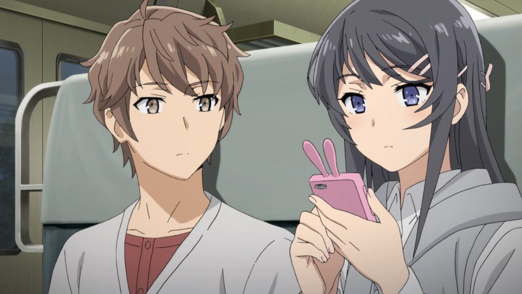
Rascal Does Not Dream of Bunny Girl Senpai is rooted in Fujisawa and the Shonan coast. Fujisawa Station, Enoshima, Shichirigahama and nearby Kamakura provide the real streets, stations, beaches and landmarks behind many of the series’ most recognizable scenes.
This guide covers the original 2018 TV anime and the nearby locations used again in the first high-school-era films. It keeps the route selective so you can understand what you are looking at, move through the area sensibly and avoid treating a fictional place or a fan theory as a confirmed address.
At a glance
- Main area: Fujisawa, Enoshima and the Shonan coast in Kanagawa.
- Best transport spine: the Enoden between Fujisawa, Shichirigahama and the Enoshima area.
- Strongest clusters: Fujisawa Station, Shichirigahama/Kamakura and Katase-Enoshima.
- Later Yokohama locations from the university arc are outside this guide.
The easiest way to plan the pilgrimage is to follow the geography. Shonandai is a separate story-origin detour, Fujisawa is the urban starting point, the Enoden carries you toward Shichirigahama and Kamakura, and the route finishes around Katase-Enoshima and the island.
Shonandai
Fujisawa City General Library
The library is the real-world location most closely tied to the beginning of Mai and Sakuta’s story. In Episode 1, Sakuta sees Mai in her bunny-girl outfit inside the library, where nobody else seems able to notice her. The building is in Shonandai rather than beside Fujisawa Station, so treat it as a separate stop instead of squeezing it into the coastal walk. Its inland setting also makes it a useful first stop if you want to follow Sakuta’s story before heading back toward the coast.
Fujisawa City General Library on Google Maps is an operating public library. Check its current opening hours and photography rules before entering, keep the visit quiet and do not photograph staff or readers. The official Fujisawa material and local library coverage make this one of the clearest stops in the pilgrimage.
Fujisawa Station and the city route
Fujisawa Station
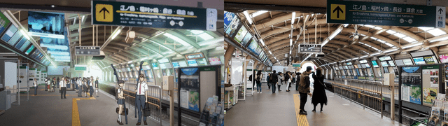
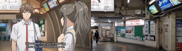
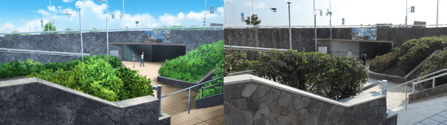
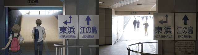
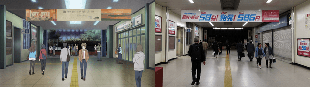
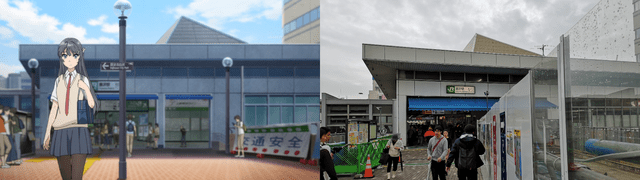
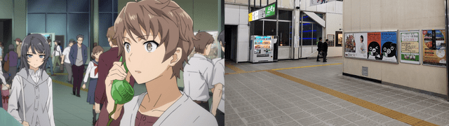
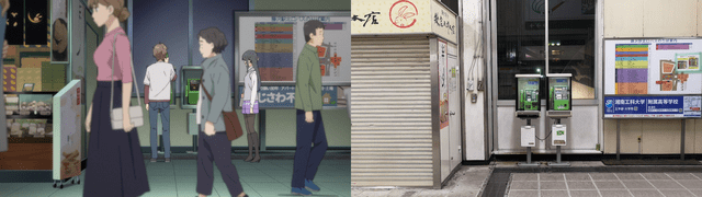
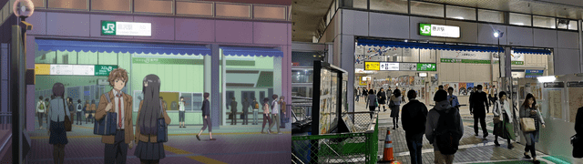
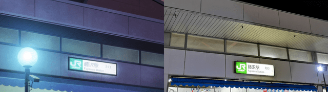
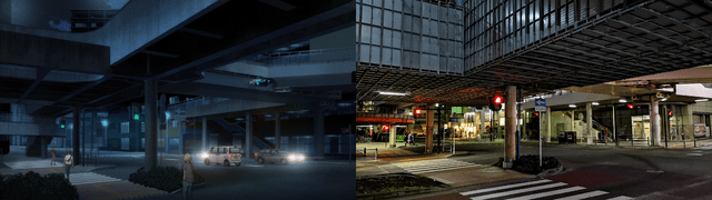
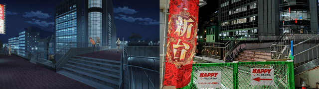
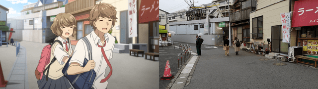
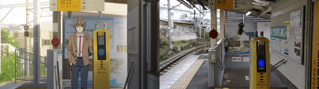
The Fujisawa Station is the practical anchor for the route and one of the series’ recurring everyday settings. The JR and Enoden sides both matter, and the north-exit area leads into streets used for station, shopping and walk-home scenes. Start here if you want the compact city portion before taking the Enoden toward the coast. Open Fujisawa Station in Google Maps
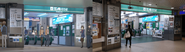
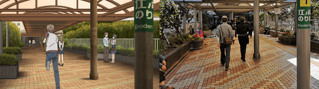
Several older comparisons place additional shops and signs around the station. Keep those as visual leads rather than treating every renamed storefront as a confirmed anime model. The useful, stable destination is the station itself and the surrounding public street network.
Taisho Bridge
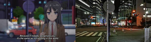
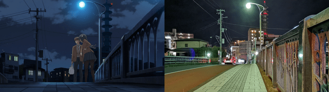
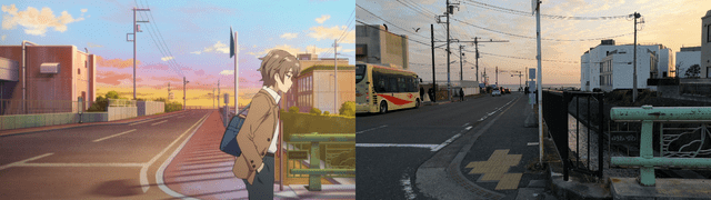
Taisho Bridge crosses the Sakai River a short walk from Fujisawa Station and appears in Episode 4. It is easy to recognize, open to the public and naturally fits the walk between the station area and the Gosho-ga-ya side of Fujisawa. Open Taisho Bridge in Google Maps
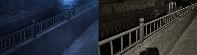
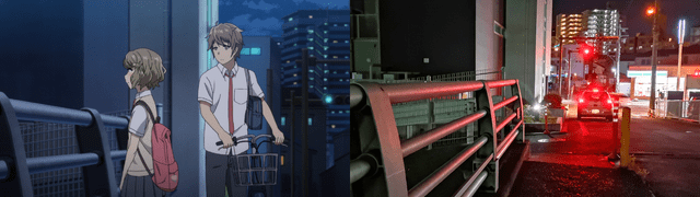
Watch traffic, stay on the pavement and avoid stopping in the roadway for a comparison photo. The bridge is a working part of the neighbourhood, not a viewing platform.
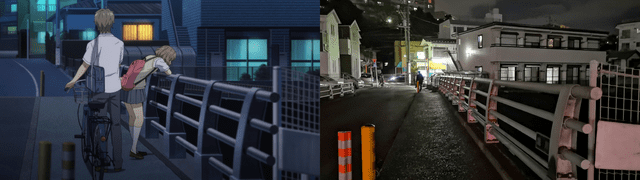
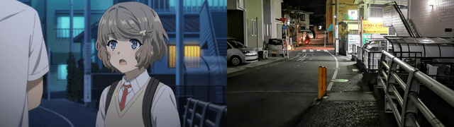
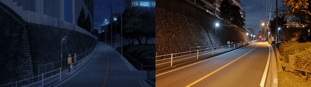
Gosho-ga-ya Park and bridge
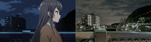
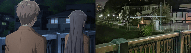
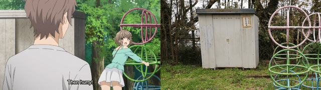
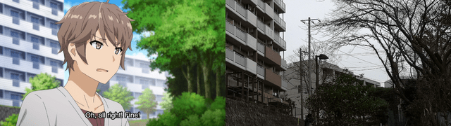
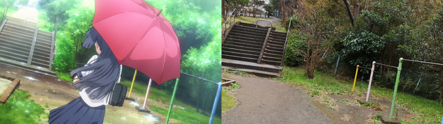
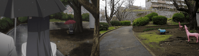
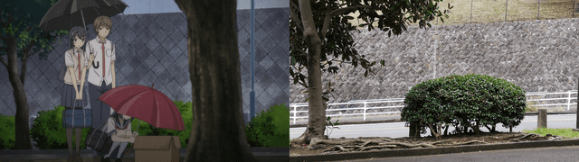
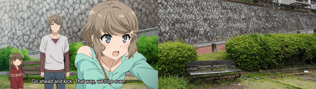
The Gosho-ga-ya area gives the Fujisawa section its most characterful everyday scenes. The park and nearby bridge are commonly linked with conversations and confrontations involving Sakuta, Tomoe and Shoko. Because this is a residential setting, keep the visit brief and quiet, and never photograph homes or residents. Find Gosho-ga-ya Park in Google Maps
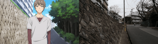
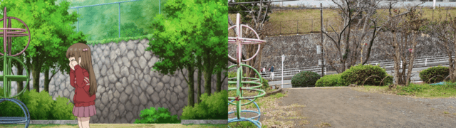
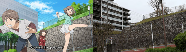
Denny’s Fujisawa North Exit
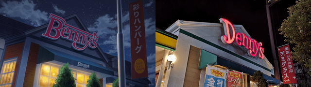
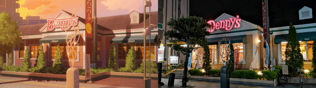
Fans commonly identify Denny’s Fujisawa North Exit as the model for the series’ “Benny’s” restaurant. The restaurant is real and currently listed at Fujisawa 1015, but the anime connection is a fan-attributed model identification rather than official confirmation. Visit only as a normal customer and follow the restaurant’s current rules. Open the Fujisawa North Exit listing in Google Maps
Shichirigahama and Kamakura
Shichirigahama Station
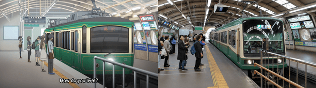
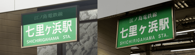
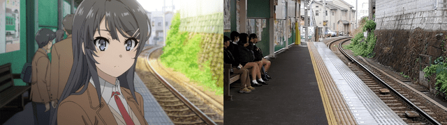
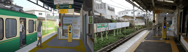
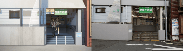
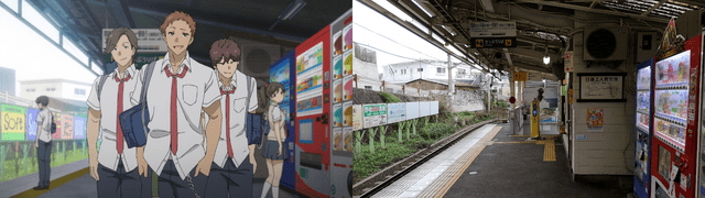
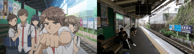
The Shichirigahama Station is one of the clearest recurring points on the coastal route. The station, tracks and surrounding sea-facing landscape appear repeatedly across the TV series and films, making it a better anchor than a vague “Fujisawa coast” label. Open Shichirigahama Station in Google Maps
Yukiai Bridge and Shichirigahama Beach
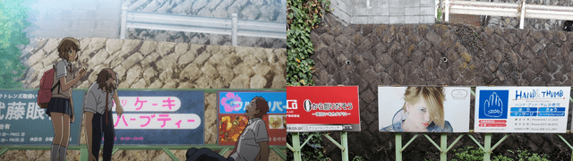
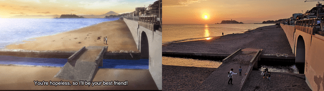
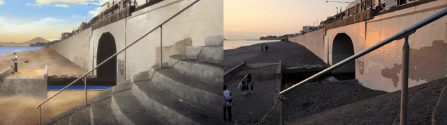
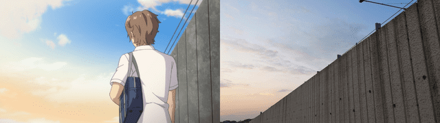
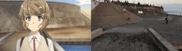
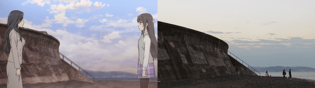
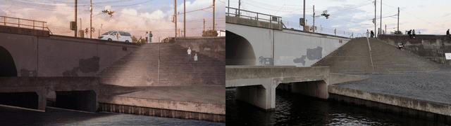
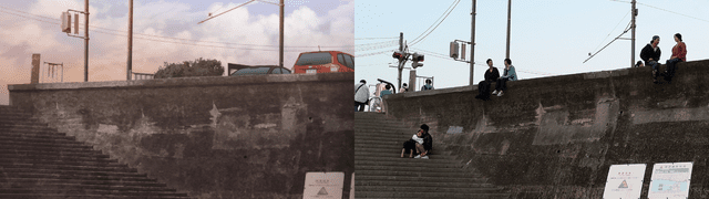
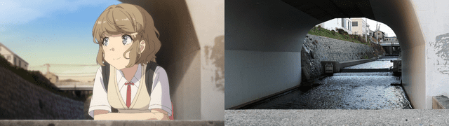
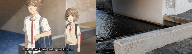
Yukiai Bridge is identified with Episode 2 material and sits beside the Shichirigahama route. Nearby Shichirigahama Beach supplies the series’ most recognizable open-sea setting and returns in later film material, including Knapsack Kid. The nearby Yukiai Bridge is another useful coastal reference point. The seawall, rail line and long view toward Enoshima work best as one connected coastal sequence rather than a single sand-only stop.
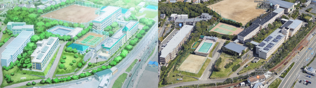
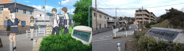
Shichirigahama High School and Minegahara
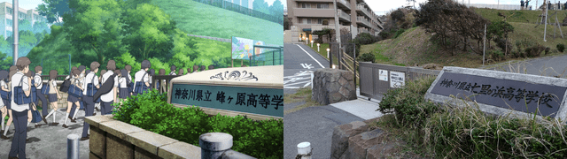
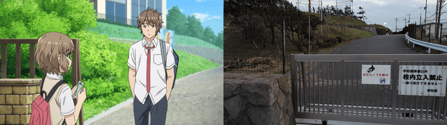
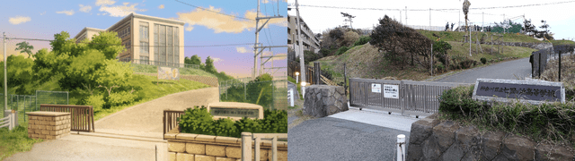
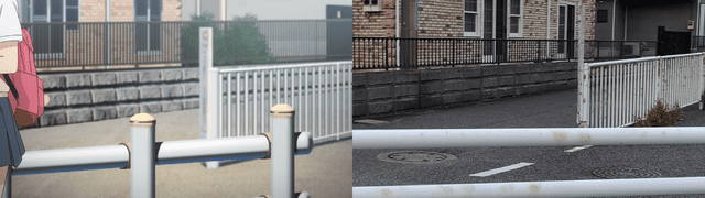
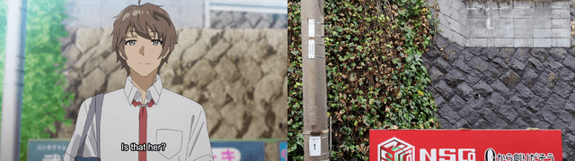
Minegahara High School is fictional. Fans commonly associate its exterior and surrounding views with Shichirigahama High School and the nearby Shonan coast, but that does not make the real school a confirmed one-to-one replacement for Minegahara.
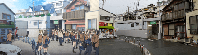
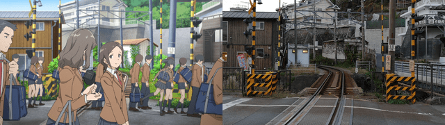
Shichirigahama High School is an active school. Do not enter the grounds, photograph students, obstruct entrances or linger around school activity. Treat the association as an exterior and landscape comparison viewed from lawful public areas. The visual match is strongest in the surrounding slope, road and coastal outlook; the fictional school building is not a one-to-one copy of the campus.
Kamakurakokomae crossing
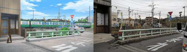
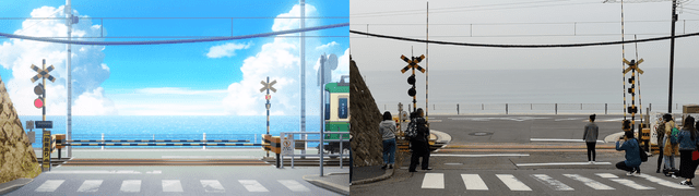
The crossing near Kamakurakokomae is an optional stop for fans who want the wider Shonan anime landscape. It is also famous for Slam Dunk, so the area can be extremely busy. Its Bunny Girl Senpai connection is quieter than its Slam Dunk reputation, but it still fits the coastal setting and pairs naturally with Shichirigahama. Use public viewing areas, follow local instructions and do not step into the road. Open the Kamakurakokomae crossing in Google Maps
Katase-Enoshima and Enoshima
Katase-Enoshima Station and the beaches
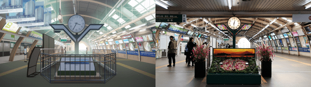
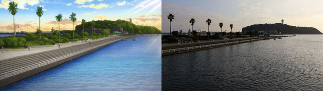
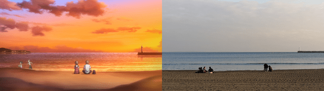
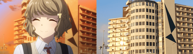
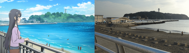
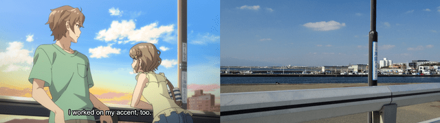
The Katase-Enoshima Station is the natural gateway to the island side of the route. Katase Nishihama is the better fit for the broad Enoshima-facing beach views, while Katase Higashihama works as the quieter continuation along the shore. Nearby Katase Nishihama and Katase Higashihama provide the open beach settings used by the series, while Katase-Enoshima Station and the bridge approaches connect them to a practical walking route.
Enoshima Benten Bridge
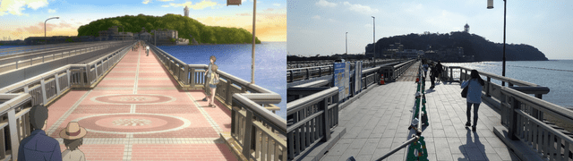
Benten Bridge is the visual handoff between the mainland and Enoshima. It appears in the TV series and in Dreaming Girl, and it is one of the easiest places to understand how real island geography shapes the story. Crossing it gives you the clearest transition from Katase’s mainland streets into the island route. Open Enoshima Benten Bridge in Google Maps
Enoshima Shrine and Hetsunomiya
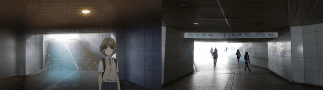
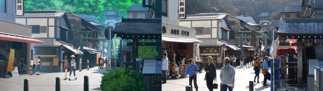
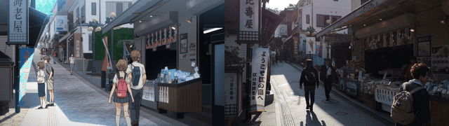
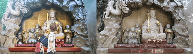
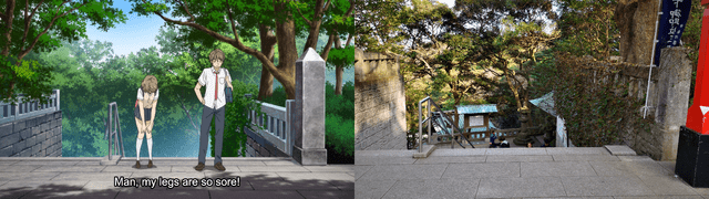
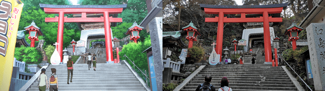
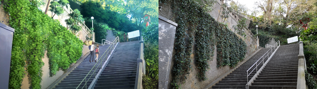
The shrine approach, stairs and Hetsunomiya area form one of the most recognizable Enoshima sequences. The red torii, rising path and upper-island views are more useful to visit as one continuous walk than as disconnected pins. The stairway and shrine approach make the anime’s movement through Enoshima easier to read in person. Find Hetsunomiya Shrine in Google Maps
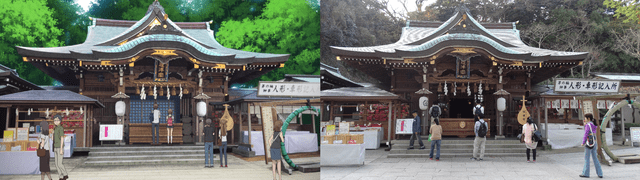
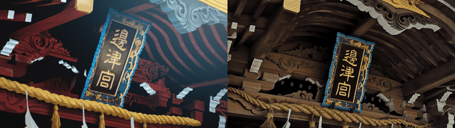
Enoshima Shrine is an active place of worship. Follow shrine signage, keep voices low and ask before taking photographs where restrictions apply.
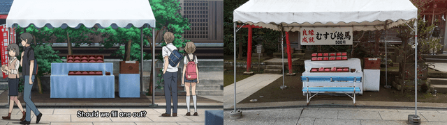
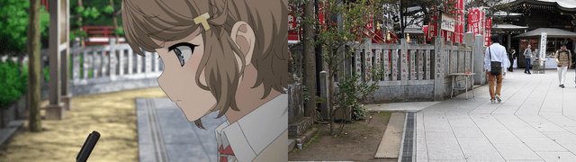
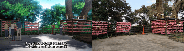
Nakatsumiya and the Sea Candle
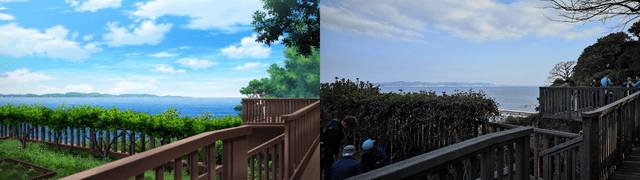
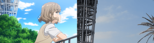
The Nakatsumiya viewpoint and Sea Candle area give the island section its strongest elevated views. Nakatsumiya is a useful pause on the climb, while the Sea Candle is the recurring visual landmark that makes the island skyline immediately recognizable. Together they explain the wide coastal compositions used throughout the series. Open Nakatsumiya in Google Maps and Open the Sea Candle in Google Maps.
Admission, opening hours and weather access can change, so check current official Enoshima information before building the stop around sunset or evening lighting.
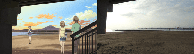
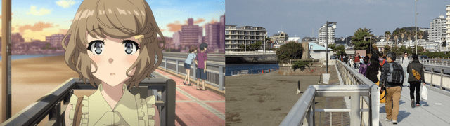
Enoshima Aquarium
Enoshima Aquarium is a substantial destination rather than a quick photo stop. The series uses the aquarium for date and meeting scenes, and the real venue remains easy to reach from Katase-Enoshima Station. Its official access page lists the current address, station walks, accessibility information and photography rules. Open Enoshima Aquarium in Google Maps
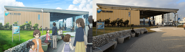
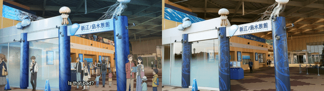
Allow time for the exhibits if you are entering. Flash restrictions and commercial photography rules apply in parts of the facility, so follow staff instructions rather than trying to recreate an anime frame at the expense of other visitors.
Planning the pilgrimage
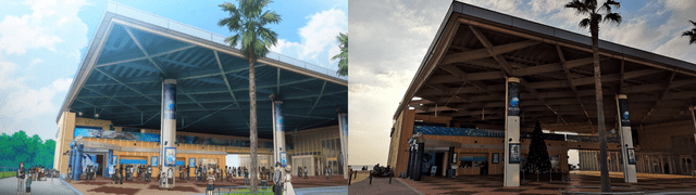
For the shortest useful visit, choose Fujisawa Station plus one coastal section. A longer day can start with the Shonandai library, return to Fujisawa, follow the Enoden toward Shichirigahama, and finish at Katase-Enoshima or Enoshima. Do not assume every stop belongs in one uninterrupted walking route.
The Enoden’s official Noriorikun pass allows unlimited travel across the line on its issue date. Current fare and purchasing details are published by Enoshima Electric Railway. The official Fujisawa tourism map and Enoshima Aquarium access page are useful for current visitor information.
Use public paths, do not trespass at schools or residences, do not photograph people without permission, keep station platforms clear and remember that shops, libraries, shrines and restaurants are working places for local residents.
Frequently asked questions
Where is Bunny Girl Senpai set?
The story is mainly set around Fujisawa and the Shonan coast in Kanagawa, including Shichirigahama, Kamakura and Enoshima. Later university-arc material expands into Yokohama, which is outside this focused guide.
Are the Bunny Girl Senpai locations real?
Many recognizable backgrounds and public landmarks are real places, especially the stations, beaches, bridges, shrine areas and aquarium around Fujisawa and Enoshima. Some character locations are fictional or fan-identified visual models, so they should not all be treated as confirmed one-to-one addresses.
Where is Minegahara High School in real life?
Minegahara High School is fictional. Fans commonly associate its exterior and nearby coastal views with Shichirigahama High School, but visitors should view the school only from lawful public areas and must not enter or disturb the active campus.
Is Enoshima in Bunny Girl Senpai?
Yes. Enoshima appears throughout the series’ coastal setting, including the bridge, shrine approach, viewpoints and Sea Candle area.
Can you visit the locations?
Yes, most major stops are public stations, beaches, bridges, shrine grounds or visitor venues. Check current access information for ticketed attractions and treat schools, libraries, restaurants and residential streets as working places rather than photo props.
Useful related guides
The coastal crossing near Kamakurakokomae also appears in our Slam Dunk locations guide. For another anime route that uses Enoshima, see the Bocchi the Rock locations guide. The broader anime locations hub is useful when comparing destinations across Japan.

Show Your Work
Whether you are a professional or an amateur, we will love to see your artwork. So don't hesitate to remove your cats from your box right away